Metadata for the treeline map
The map shows the position of treeline sites across the world for which information and/or images are provided to show the type of vegetation and spatial pattern of the treeline ecotone. The information and pictures are provided by network members or guests, based mostly on observations on the ground, in the field, and partly on observations from airplanes or based on high-resolution satellite images. To contribute sites to the map, please see this page.
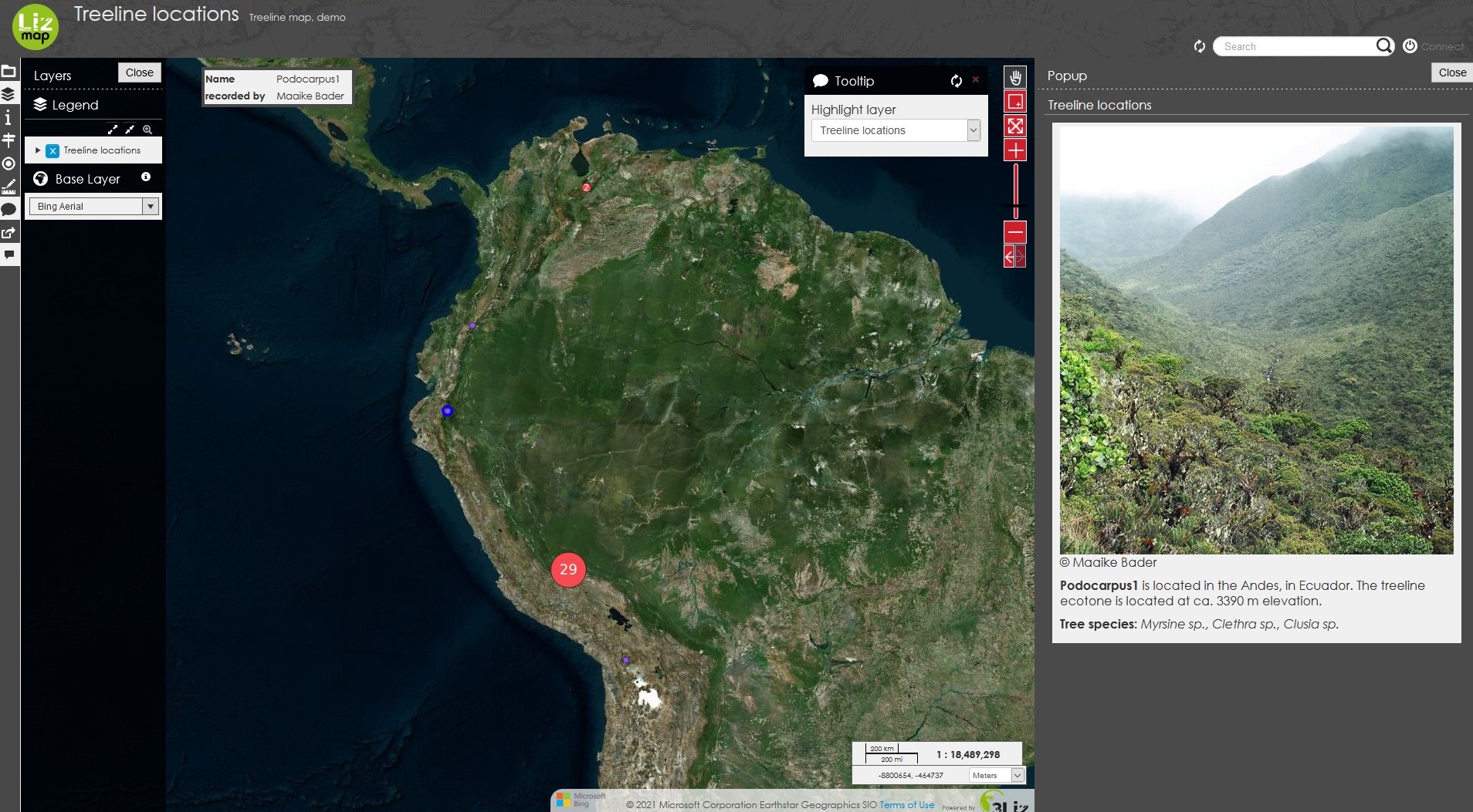
The WebGIS environment is Lizmap. For unregistered users, a basic version of the WebGIS is available to view the available treeline points. Clicking on a point will open the Popup toolbar on the right side of the map, with information about the point(s), including, in the current demo version, a picture (if available), the site name, mountain range and country, elevation, and treeline-forming tree species and, if available, tall shrub and main alpine plant species. Activating the Tooltip toolbar causes a tooltip (site name and contributor) to appear when hovering over the point. The base layer can be varied between an Open Street Map map and a Bing aerial image using the Layers toolbar. Treelines can be searched by country and site name using the Locating toolbar.

Impression of the Lizmap WebGIS interface. Set up by Christiane Enderle and Spaska Forteva, Faculty of Geography, University of Marburg.